Seismic engineering in Gisborne addresses the unique challenges posed by one of New Zealand's most seismically active regions. Situated near the Hikurangi subduction zone, where the Pacific Plate descends beneath the Australian Plate, Gisborne experiences frequent earthquakes ranging from deep subduction events to shallow crustal ruptures. This category encompasses the full spectrum of seismic design and assessment services required to protect structures, infrastructure, and communities from earthquake-induced damage. From new building design to retrofitting existing assets, seismic considerations are not merely regulatory requirements but essential safeguards for life safety and economic resilience in the Tairawhiti region.
The local geology of Gisborne amplifies seismic hazards in ways that demand specialised attention. Much of the city and surrounding plains are underlain by alluvial sediments, including sands, silts, and gravels deposited by the Waipaoa and other rivers. These soft soil profiles can significantly amplify ground shaking compared to rock sites, while the high water table across the Poverty Bay flats creates conditions ripe for soil liquefaction. The 2007 Gisborne earthquake, though moderate in magnitude, demonstrated how local ground conditions can lead to uneven damage patterns. A thorough understanding of these subsurface conditions through seismic microzonation studies is fundamental to any robust seismic design strategy in the district.
New Zealand's seismic regulatory framework is among the most advanced globally, governed primarily by the Building Act 2004 and the associated Building Code. For Gisborne, compliance typically references NZS 1170.5 for seismic actions, which defines site-specific hazard spectra based on location and soil class. The Building Code Clause B1 sets performance objectives for structural stability, while the Earthquake-prone Building provisions of the Building Act require assessment and strengthening of existing structures below certain thresholds. Engineers practising in Gisborne must also consider the NZ Geotechnical Society guidelines for liquefaction assessment and the MBIE guidance on foundation design in seismic areas. These standards collectively ensure that designs account for the region's particular seismotectonic setting.
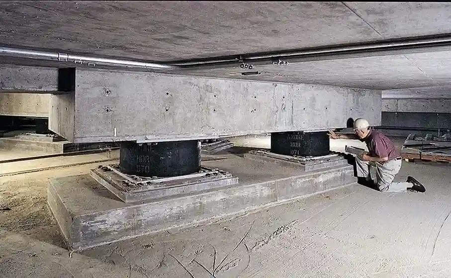
Projects requiring comprehensive seismic input range from residential subdivisions on liquefaction-prone land to multi-storey commercial buildings and critical infrastructure. Industrial facilities such as wineries and food processing plants, which form the backbone of Gisborne's economy, often require advanced analysis to maintain post-earthquake functionality. Bridge and highway projects traversing alluvial valleys demand rigorous soil liquefaction analysis to prevent loss of foundation bearing capacity. For essential facilities like hospitals and emergency response centres, base isolation seismic design can provide the enhanced performance needed to remain operational after a major event. Each project type presents distinct challenges that call for tailored seismic engineering approaches.
Quick answers
What are the main seismic hazards that affect Gisborne?
Gisborne faces multiple seismic hazards including strong ground shaking from the Hikurangi subduction zone and shallow crustal faults, soil liquefaction in the alluvial plains due to high groundwater, lateral spreading along riverbanks, and earthquake-induced landslides in the surrounding hill country. The deep alluvial sediments beneath the city can amplify shaking significantly compared to rock sites, making site-specific hazard assessment essential for any development.
Do I need a seismic assessment for a residential property in Gisborne?
While standalone residential buildings on good ground may not require detailed seismic analysis, properties on the Poverty Bay flats or near waterways often need assessment for liquefaction potential. Subdivisions and multi-unit developments typically require geotechnical investigation to demonstrate compliance with Building Code requirements. If your land has been identified as potentially liquefaction-prone on council hazard maps, a site-specific assessment is strongly recommended before construction.
How does the New Zealand Building Code address seismic design in Gisborne?
The Building Code works through NZS 1170.5, which specifies seismic hazard factors for Gisborne based on its location and proximity to active faults. Engineers must determine the site soil class through investigation, then apply the corresponding spectral shape factors. The code sets minimum performance levels for life safety, with higher standards for important buildings. Earthquake-prone building legislation also mandates assessment and strengthening timeframes for existing structures below 34% of new building standard.
What is the difference between seismic microzonation and a standard site investigation?
A standard site investigation typically assesses ground conditions at a single location through boreholes or probes, providing data for foundation design. Seismic microzonation maps variations in ground shaking potential, liquefaction susceptibility, and other hazards across a broader area such as a suburb or town centre. It integrates geological mapping, geophysical surveys, and multiple investigation points to create hazard maps that inform land-use planning and infrastructure resilience at a community scale.